MANILA, Philippines — The weather disturbance “Dante” has entered the Philippine area of responsibility after intensifying from a tropical depression to a tropical storm but is not expected to make landfall.
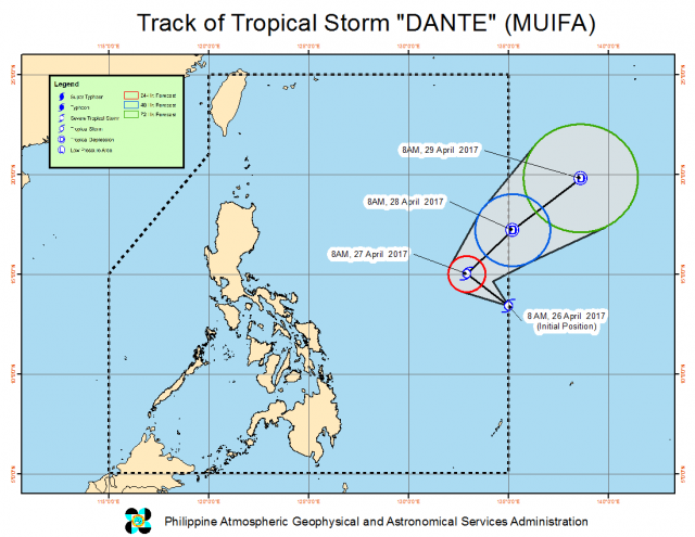
In fact, the storm’s path, as projected by the Philippine Atmospheric, Geophysical and Astronomical Services Administration, indicates that Dante, which is currently moving northwest at 11 kilometers per hour, will veer off in the opposite direction, northeast, on Thursday morning and leave the PAR by Friday.
Late Wednesday morning, Pagasa tracked Dante 1,170 kilometers east of Virac, Catanduanes packing maximum sustained winds of 65 kph with gusts of up to 80 kph.
Rainfall within the storm’s 300-kilometer diameter is expected to be moderate to heavy.
Dante is forecast to be 1,165 km east of Casiguran, Aurora Thursday morning and 1,445 km east of Aparri, Cagayan the day after.


