


MANILA, Philippines — A new storm east of Mindanao is forecast to enter the Philippine area of responsibility either later Wednesday or early Thursday.
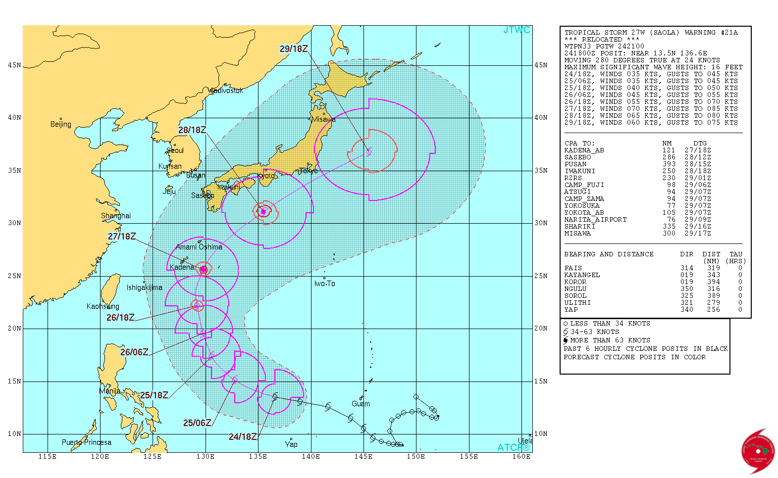
The Philippine Atmospheric, Geophysical and Astronomical Services Administration said it had last tracked Tropical storm “Saola” was last tracked 1,405 kilometers east of southern Luzon packing winds of 80 kilometers per hour with gusts up to 90 kph as it headed northwest at 25 kph.
It will be assigned the local name “Quedan” once it enters the PAR, Pagasa forecaster Chris Perez said.
But like typhoon “Paolo” before it, Saola is not expected to make landfall but will head in the direction of Japan within the next few days, according to the projected track of the U.S. Joint Typhoon Warning Center.
Nevertheless, Eastern Visayas will experience cloudy skies with scattered rains and thunderstorms due to “Saola,” Pagasa said.
The Intertropical Convergence Zone, on the other hand, continues to affect Palawan, parts of the Visayas and the whole of Mindanao. It will bring cloudy skies with scattered rains and thunderstorms to these areas.
Metro Manila and the rest of Luzon will have cloudy skies with isolated light rains, especially in the afternoon or evening.


