


MANILA, Philippines — Rains, possibly accompanied by strong winds and lightning, that could trigger flashfloods or landslides are forecast for the whole country on Thursday, October 19, the Philippine Atmospheric, Geophysical and Astronomical Services Administration said.
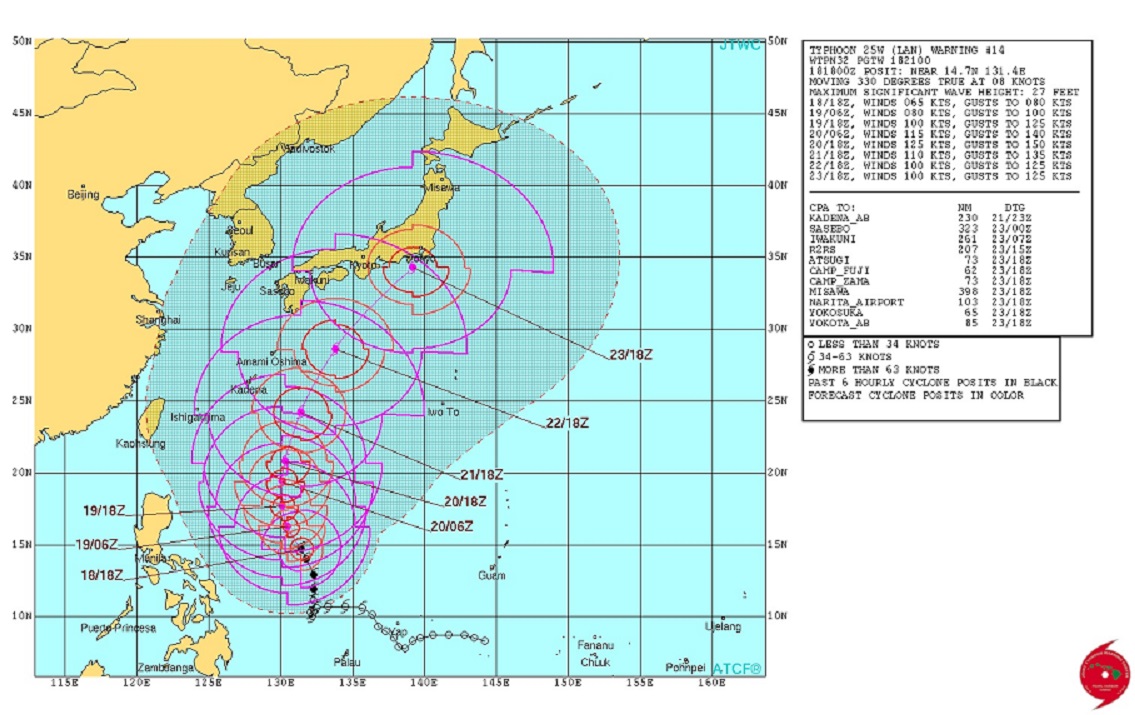
At the same time, although not expected to make landfall, typhoon “Paolo,” last tracked 895 kilometers east of Daet, Camarines Sur, is forecast to strengthen into a super typhoon by Friday, October 20, according to the U.S. Joint Typhoon Warning Center.
Currently, Paolo packs maximum sustained winds of 120 kilometers per hour near the center with gusts of up to 145 kph as it moved north-northwest at 15 kph.
By Friday, according to forecast estimates by the Japan Meteorological Agency, Paolo (international codename: Lan), should be packing winds of 176 kph gusting up to 250 kph.
Despite its distance, Paolo is expected to induce possible moderate to heavy rains that could trigger “serious flooding” and landslides in the Visayas, Mindanao, the Bicol region and the provinces of Mindoro, Marinduque and Romblon.
Similar weather conditions should be felt in Palawan because of a low pressure area last tracked 185 km west of Puerto Princcesa City.
Metro Manila and the rest of Luzon can expect partly cloudy to cloudy skies with isolated rain showers or thunderstorms, mostly in the afternoon or evening.


