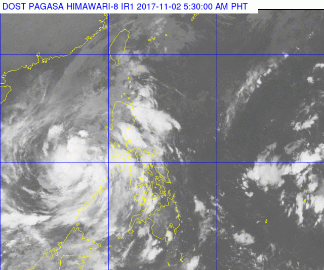
MANILA, Philippines — (UPDATE – 6:57 a.m.) Tropical depression “Ramil” maintained its strength as it blew over the West Philippine Sea and is expected to leave the country Thursday night, November 2, or early Friday.
The continued bad weather also led to class suspensions in some areas. These are in:
- Batangas
- Cagayan province
- Calapan, Oriental Mindoro
- Cavite
Other places suspended classes in observance of All Souls’ Day:
- San Remigio, Cebu
- Butuan
- Cauayan, Isabela
- Ilagan, Isabela
- San Pablo, Laguna
- Tacloban
- Angono, Rizal
SCHOOL:
- Ateneo de Davao University
Early Thursday, Ramil was tracked 230 kilometers west of Coron, Palawan packing maximum sustained winds of 55 kilometers per hour near the center with gusts of up to 65 kph as it moved west at 15 kph.
Although storm warning signals earlier raised have been taken down, the Philippine Atmospheric, Geophysical and Astronomical Services Administration said moderate to occasionally heavy rains are still expected over the Mindoro provinces, Palawan, Batangas, northern Quezon including Polillo Island and Aurora.”
It warned residents of these areas against possible landslides and flashfloods.
Light to moderate rains, occasionally turning heavy during thunderstorms, will still prevail over Metro Manila and most of Luzon, except for the Ilocos region, which can expect cloudy skies with light rains due to the northeast monsoon or “amihan.”
The Visayas and Mindanao will have partly cloudy to cloudy skies with isolated rain showers or thunderstorms, with possible lightning and strong winds.


