


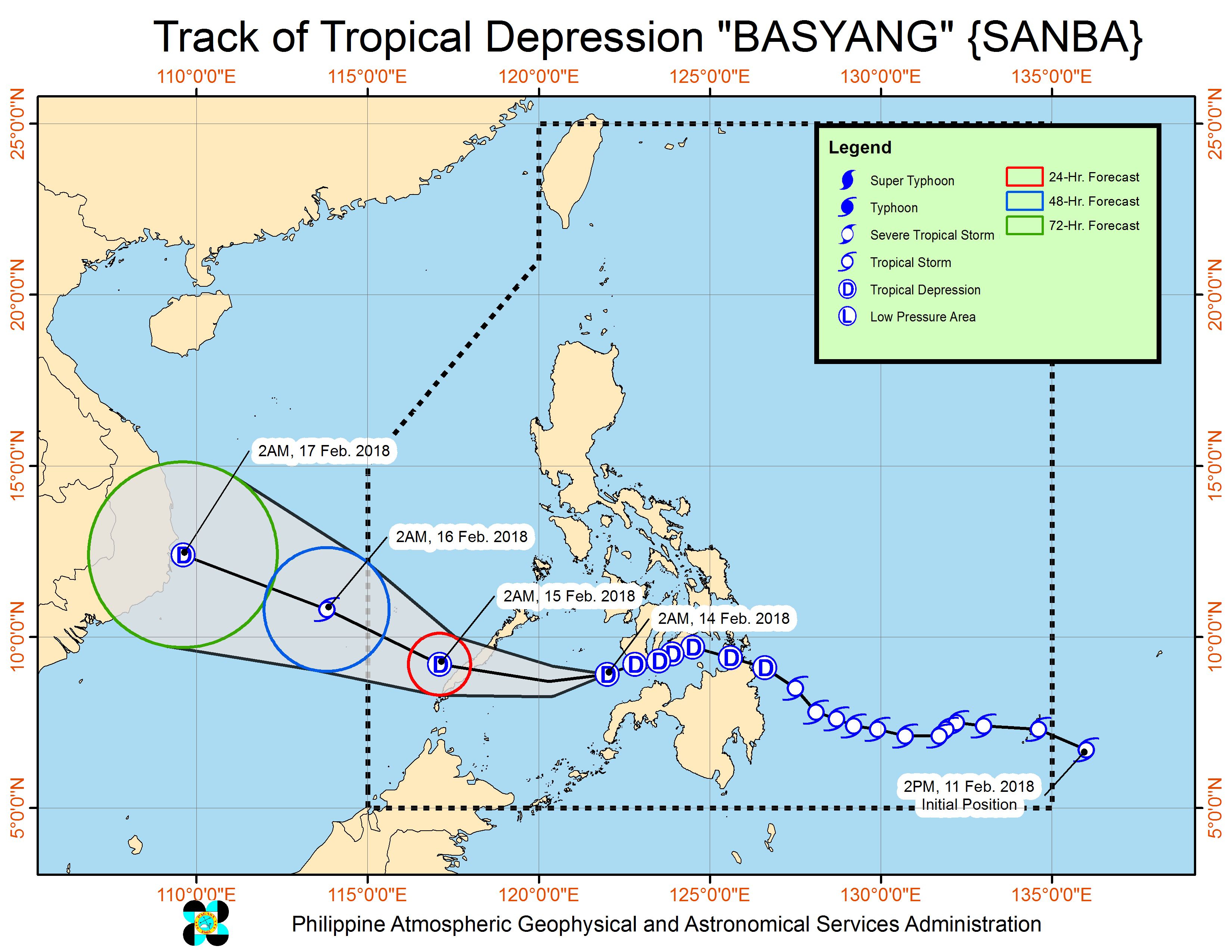
MANILA, Philippines — (UPDATE – 12:27 p.m.) Tropical depression “Basyang” began crossed the Sulu Sea Wednesday, February 14, on its way to possible landfall over southern Palawan in the evening as the northeast monsoon continued to affect Luzon.
Late Wednesday morning, Basyang was last tracked 200 kilometers southeast of Puerto Princesa City, with maximum sustained winds of 45 kilometers per hour gusting up to 60 kph and moving west at 23 kph.
Only Palawan, including the Calamian and Cuyo island groups, remained under Tropical Cyclone Warning Signal No. 1, meaning winds of 30-60 kph are expected in 36 hours.
The Philippine Atmospheric, Geophysical and Astronomical Services Administration said scattered to widespread moderate to heavy rains will prevail over the next 24 hours over Palawan, Bicol Region, and Eastern Visayas, while scattered light to moderate with at times heavy rains are expected over the rest of the Visayas due to the combined effects of Basyang and the tail-end of a cold front.
It warned residents of these areas to “continue monitoring for updates, take appropriate measures against possible flooding and landslides, and coordinate with their respective local disaster risk reduction and management offices.”
The weather bureau said sea travel would remain risky over the seaboards of Northern Luzon and Palawan, the eastern seaboards of Central Luzon and of Visayas and the eastern and western seaboards of Southern Luzon.


